UAV for Disaster Mitigation and Management
Drone Technology
Drone use has grown rapidly over the last decade, including a number of areas ranging from agricultural to commercial and becoming more prevalent in disaster management or humanitarian help. Floods and earthquakes are among the most frequently occurring natural disasters. This initiative intends to manage flood-related post-disaster situations. The manual Search and Rescue operations have their shortcomings due to the difficulties in identifying the human presence. In such a case, the drone can be utilised to detect human presence in a disaster-affected region.
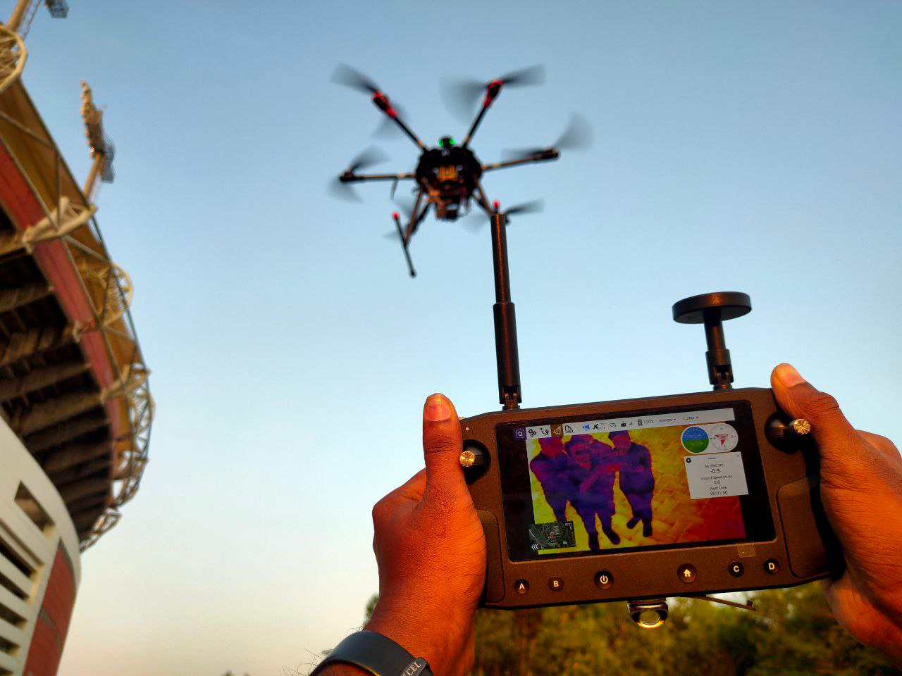
Monitoring of disasters is crucial for mitigating their effects on the environment and human population, and can be facilitated by the use of unmanned aerial vehicles (UAV), equipped with camera sensors that produce aerial photos of the areas of interest.The objective of the project is to design and assemble a drone for human body detection as part of disaster mitigation and management, with a thermal camera as a payload for taking videos.
Regarding hardware, multicopter Tarot X6 960mm 6-Axis PCB Centre Plate Folding FPV Hexacopter Frame has been assembled with accessories such as motor, propeller, ESC, and so on. Ground control is provided via the Herelink Ground unit and the Herelink Air unit. Tattu 22.2V 25C 6S 22000mAh Lipo Battery had been used to power the UAV. The FLIR Vue Pro R thermal camera with 3-axis gimbal served as payload to take the videos. All up weight of drone is 7.124 Kg and its flying duration is up to 20 minutes.
Regarding software, MissionPlanner is used to calibrate and configure the drone. YOLO v5 object detection algorithm is used to detect the presence humans in the live streaming video on ground station. QGC is another of software that runs on the ground control unit.
The use of thermal images and thermal cameras in search and rescue operations are nothing new. Thermal imaging on a smaller scale are used by several rescue teams across the world to detect missing individuals. This approach has two significant benefits. First of all, there is that ease of visibility. The sooner teams identify and locate someone in the flood, the sooner a rescue team can respond. The team investigating the region using a remote-controlled unmanned aircraft may cover more terrain and provide a better, bird's-eye view of the people in the vicinity. They can then inform those on the ground that may not have a good view, but are then able to go into hard to reach places and retrieve the victim. The second benefit is the increased safety for the rescue teams on the ground. Heading out to floodwater and debris is challenging and risky work, especially in poor visibility. This initiative also save valuable time.
- tags: Drone_Technology
- Share This