UAV for mapping or surveying
GIS Mapping & Drone Technology
Ability of drone to gather huge volumes of data is one of the advantages that makes them such a vital component of technology. While there are various ways that drones can collect data, drone mapping is one of the most widespread. As the name suggests, it involves using a drone to map a desired region in order to provide various kinds of useful outcomes, including an orthomosaic, digital elevation models, and 3D models. Drone mapping leads to easy to capture highly detailed data across a large area in a way that is not achievable with imagery from satellites or conventional ground surveys. An orthomosaic features scaled and georeferenceable objects. This indicates that measurements of location, distance, and area are realisable.
Drone mapping, often known as drone surveying, is a simple method of using drones to collect images of specific area. With the help of photogrammetry software, it is possible to create real 3D representations of topographic surfaces by merging overlapping, geotagged images of the same features taken from various perspectives. The objective of the project is to design and assemble a drone for mapping or surveying, with a mapping camera as a payload to capture images.
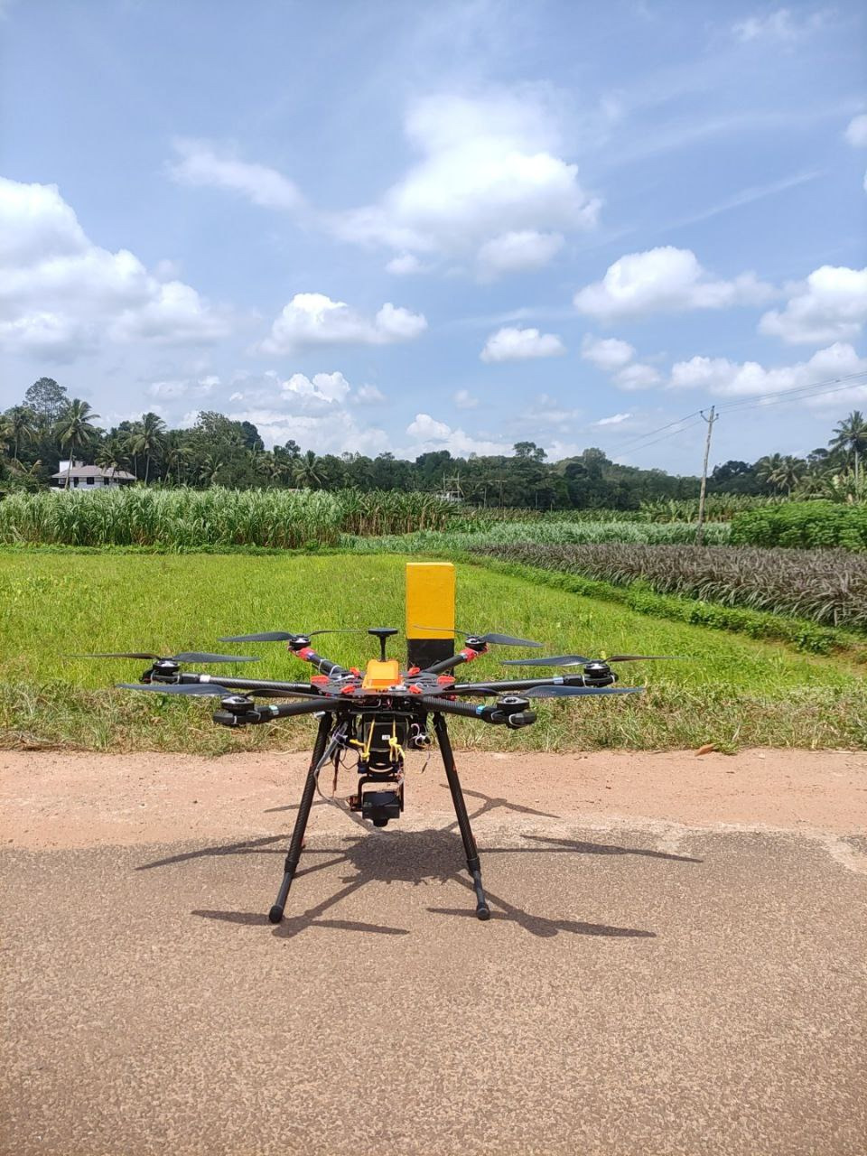
Regarding hardware, multicopter Tarot X6 960mm 6-Axis PCB Centre Plate Folding FPV Hexacopter Frame has been assembled with accessories such as motor, propeller, ESC, and so on. Ground control is provided via the Herelink Ground unit and the Herelink Air unit. Herelink is a remote controller, ground station, and wireless digital transmission system designed for use with the Cube Autopilot, Ardupilot, or PX4 flight controllers. RTK GPS coordinates obtained using the HERE+ RTK GPS module. Like other RTK GPSs, the HERE+ can provide much more accurate position estimates than regular GPSs. Tattu 22.2V 25C 6S 22000mAh Lipo Battery had been used to power the UAV. The Foxtech Map-02 Mapping Camera served as payload to capture images. It is a good option for those customers who are looking for a small and light high-quality mapping camera. With the light weight and small size, Foxtech Map-02 camera can be easily integrated into UAVs and airplanes to do mapping jobs. All up weight of drone is 7.124 Kg and its flying duration is up to 20 minutes.
Regarding software, MissionPlanner is used to calibrate and configure the drone. OpenDroneMap (ODM) has a user-friendly web interface called WebODM. In order to process drone images and produce point clouds, 3D models, and orthophotos.. QGC is another of software that runs on the ground control unit.
A broad range of uses possible with drone mapping. The activities include mining, aggregates, waste management, construction, and land surveying etc. Drone mapping and surveying can deliver the most precise surveying findings in the quickest and most economical manner. While conventional surveying and base-and-rover surveys can also produce very precise findings, they require a significantly larger amount of time and resources. They can also be significantly more errors prone than drone mapping and require more specific skill sets to operate. Drone mapping can deliver very precise surveying records across large areas of space using a technique called photogrammetry.
- tags: Drone_Technology
- Share This
Project Updates
Related Projects