DRONE® CoE
DRONE® CoE
DRONE® CoE
We have a team of experts in drone hardware, remote sensing sensors, and software.
- Key Activities
Open Designs on UAVs
Drone based Aerial mapping
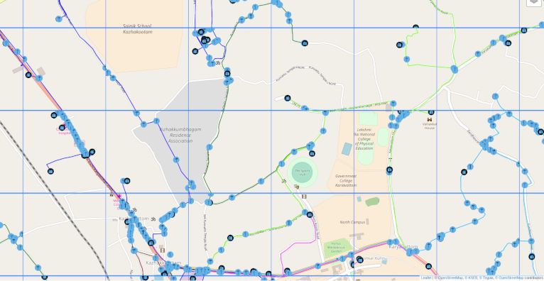
OpenStreetMap Contributions
Emerging Technology Awareness Programmes
Technology Consulting - CoE Milestones
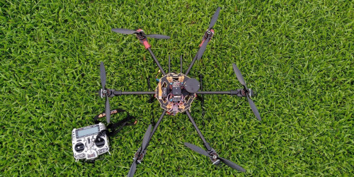
Designed and Developed Hexacopter Drone using Free software and hardware
Drone based Land Use mapping at Niranam Grama Panchayath
Structural Mapping of GreenField Stadium
Mapping Canal System within Thrissur Kole Wetlands
Corridor Mapping at Kariavattom-Thrippadapuram Road
3D modelling and mapping at Karakulam GramaPanchayath

Related Projects
Automate & Simplify The Whole Process
Topographical Mapping and volumetric Analysis
The pilot project done by ICFOSS was the topographical mapping at Vagamon Hills, Idukki. The data acquired was further processed for the study on High Accuracy Topographic Modelling via UAV-based Images. 3Dmodels of the area was generated and further analysis of grid based cut-and-fill volume calculation was done using the data .
Read more
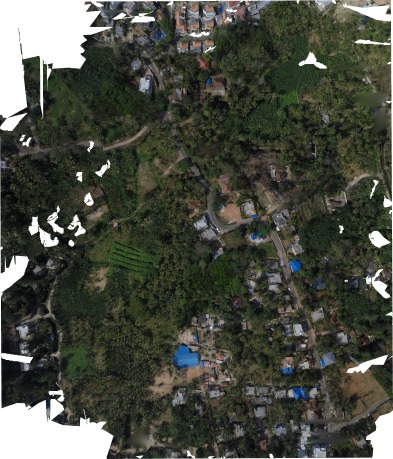
3D modelling and mapping at Karakulam Grama Panchayath
Objective of mapping was to identify the potential of RGB based photogrammetry in the field of watershed analysis and agriculture. The research was carried out at places with higher slope gradient inorder to identify and demarcate watershed basins and stream channels.
Read more

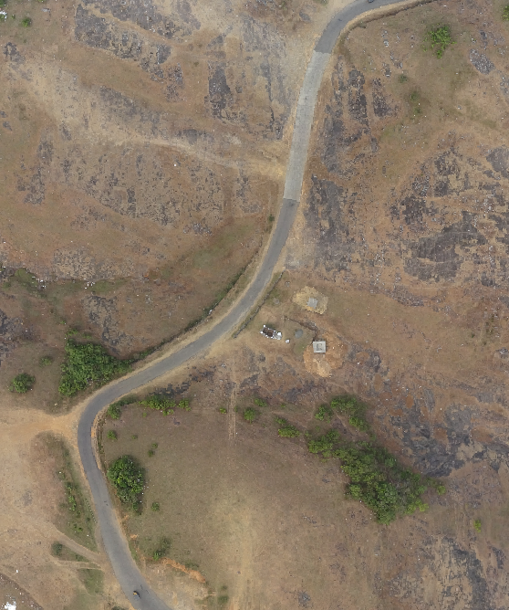
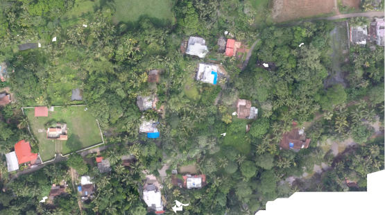
Corridor Mapping at Kariavattom-Thrippadapuram Road
As part of the POC for the Rebuild Kerala initiative ICFOSS mapped 1km stretch at Thrippadapuram Rd. The objective of the project was to study road conditions and damages in the state after the disaster.
Read more

Structural Mapping of GreenField Stadium
Autonomous structural mapping using drones can be used for monitoring works in construction, damage assessment etc.Large complex structures can also be easily mapped using photogrammetry techniques.
Read more

Mapping Canal System within Thrissur Kole Wetlands
Canal system connecting Bharathapuzha and Chalakudy river is the major water resource for paddy fields at Thrissur Kole Wetlands having area around 13000 hectares from where 40% of the rice requirement of Kerala is met. The project was proposed to estimate the total water holding capacity of the canal system to stipulate the required cultivation for corresponding seasons to maximise the yield.
Read more
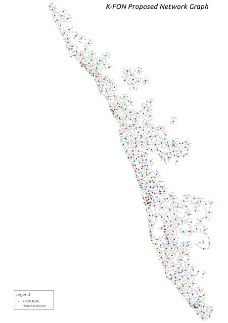
Network Analysis for K-FON
Government of Kerala aims to build a dedicated Optic Fibre Network (Kerala State Fibre Network) connecting the State HeadQuarters, Districts, the Block and Gram Panchayats in the state. A highly scalable network infrastructure has been envisioned for K-FON which shall be accessible on a non-discriminatory basis, to provide on demand, affordable broadband connectivity of 2 Mbps upto 100 Mbps for all households.
Read more
Drone based Land Use mapping at Niranam Grama Panchayath
Grameena Padana Kendram is an agency that carries out spatial planning for local development . For on ongoing project of local development using spatial as well as demographic survey the team proposed a drone mapping project as an addition to their existing survey projects.
Read more

GIS Data visualisation and analysis
The present scenario of 3D modelling at high resolution is that the data sets or its applications are not open to the public and is highly commercialized.
Read more

Open Designs on UAVs
The key issue in increasing adoption of aerial mapping in Kerala is the cost of the equipment and software used for it.
Read more

Survey Platforms
ICFOSS tested and deployed a comprehensive solution for field level survey with mobile phones.
Read more
Comprehensive Mapping solution for KSEB
ICFOSS created a software stack using Open Street Map (OSM) and allied technologies to map power-lines for KSEB across Kerala.
Read more